
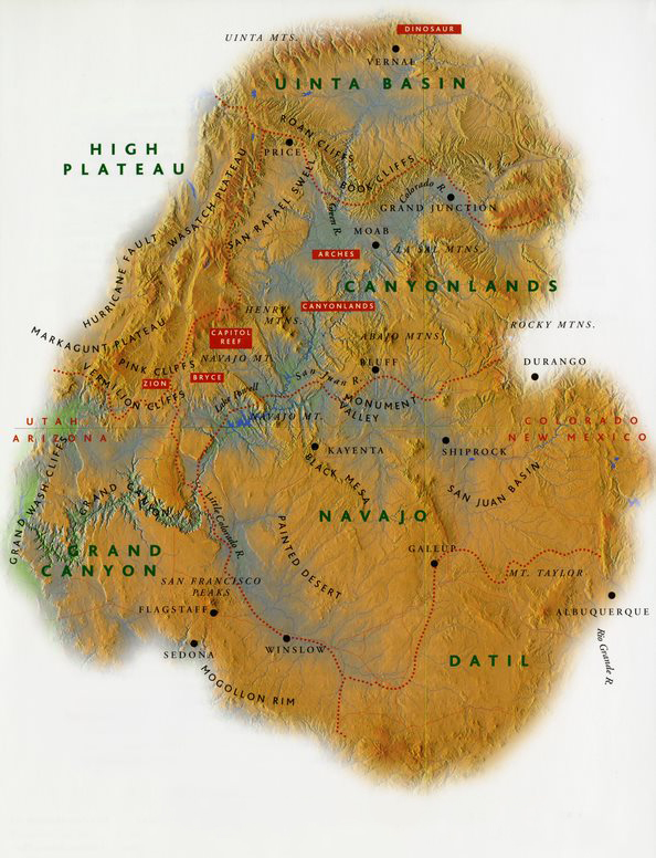
 This section is also characterized by asymmetrical bulges in the earth’s crust. From the air, it is easy to see that each upwarp has a gently-inclined flank to the west and bends steeply to the east in a single fold called a monocline. The main portion of the Grand Canyon has been carved through the bulge of the Kaibab Upwarp. Gazing northward from the Desert View Watchtower on the South Rim of the Canyon, we can see the obvious welt in the crust, flanked with the sharp fold of the East Kaibab Monocline, fading east towards the Painted Desert. Farther north into Utah, the ragged line of rock layers eroded out of this fold is known as the Cockscomb. Geologists are still arguing, 150 years after they first asked the question, about how the Colorado River carved through this fold and into what are now the highlands of the Kaibab Upwarp.
To the south and west of Grand Canyon Village, volcanic rocks spill onto the land and decorate its surface as cinder cones and other volcanoes. Perhaps a third of the Grand Canyon section is covered by volcanic rocks belched out between 8 million and 1,000 years ago. The San Francisco Peaks and Sunset Crater near Flagstaff, Arizona, crown an extensive volcanic field formed during this period, as do Vulcan’s Throne and the lava flows of the Toroweap area in western Grand Canyon. These volcanic rocks lie directly on top of the older Paleozoic sediments, the remnants of seas, rivers, and dunes hundreds of millions of years old. Thousands of feet of younger rocks found elsewhere on the Plateau were stripped away here in a massive episode of erosion before the volcanoes erupted and fissures spilled forth their lava flows.
From a distance, the San Francisco Peaks and the volcanic field’s cinder cones float on the horizon like mirages. For the Diné and Hopi nations, these islands rising from the desert floor mark the boundaries of the sacred. This is the West Mountain of the Diné and home of the Hopi Katsinas—source of pine and fir boughs used in ceremony and source of the summer rains that mature the crops. When the Katsinas return home to the Peaks at the end of July, they do so laden with the people’s prayers for rain. Standing on the grasslands and watching the cloud-wreathed Peaks before a summer storm, it is not hard to imagine the ancestors gathering to bring rain to the deserts.
Datil Section
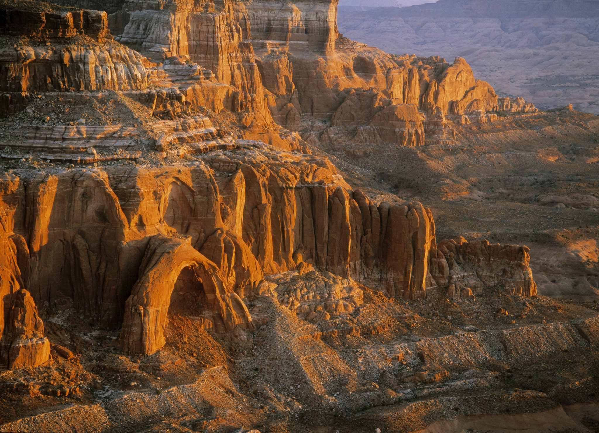
Fly now to the east, towards the New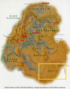 Mexico border. Cross the grasslands south of Winslow, Arizona, in the valley of the Little Colorado River far below you, and towards the Datil section. The land here is also covered by thick lavas, many of which erupted within the last 10,000 years from Mount Taylor near Grants, New Mexico. All that remains of once extensive gooey masses of lava are isolated black and twisted flows, the tire- and shoe sole-eating malpais (“bad country”) of early Spanish travelers to the region. Lava-capped mesas in western New Mexico are remnants of low places into which the lava flowed. Protected from erosion by their caps of hardened lava, these once low places were more resilient and now stand high over their surroundings, in a textbook example of what is known as “inverted topography.”
Here we are in a land of Diné legends. Mount Taylor is the Sacred Peak of the South, fastened to the earth with a great stone knife and decorated with turquoise, dark mist, and female rain. And long ago, in a time when monsters terrorized the Diné ancestors, twin heroes of divine descent were tested to manhood by killing off every monster they could find. The lava flows of western New Mexico are said to be the dried blood of one of these monsters, spilled over the land in its death throes.
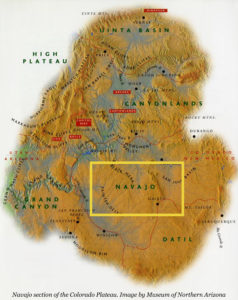 Navajo Section
Turning on the winds back to the north, we reach the Navajo section. This is a structural low point on the Plateau, where the land was warped downwards many millions of years ago into a deep basin filled over the millennia with sediments from lakes and rivers. The deepest part of this depression is the San Juan Basin in northwestern New Mexico. The same layer of rock that forms the land surface in the Grand Canyon Section lies over two miles down in the center of the San Juan Basin, buried by about 10,000 feet of later Mesozoic and Cenozoic sediments. Here are the mysterious Bisti Badlands, painted sediments from the Age of Dinosaurs that have eroded into strange and whimsical shapes, where few plants grow on the low shale hills to break the fierce grip of the wind. Oil and natural gas wells sprout from the land’s surface to suck deep into ancient reservoirs formed millions of years ago in the ever deepening pile of sand and mud accumulating in the basin’s depths.
We fly over the Defiance Upwarp, into which Canyon de Chelly’s pale sandstone walls have been carved. This high bulge separates the San Juan Basin from the Black Mesa Basin to the west. Black Mesa rises in defiance of erosion, composed of ancient sea and shoreline sediments preserved as a massive plateau, the core of which hides the coal deposits that formed as plants along the shores of this ancient seaway lived, died, and accumulated in a thick pile. At the foot of Black Mesa lie the rumpled badlands of northern Arizona’s Painted Desert, spread out below our wings in a pastel carpet; remains of an ancient “Mississippi” that flowed west from Texas to the coastline in Nevada over 200 million years ago. The earth’s earliest dinosaurs wandered these lands, foreshadowing more than 150 million years of ecological dominance.
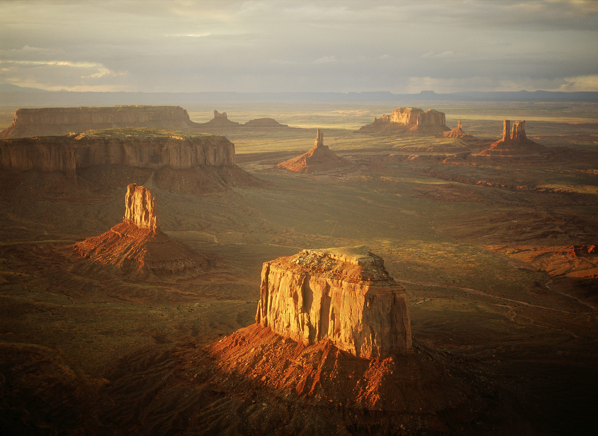
The Navajo section is a landscape studded with volcanic necks such as Agathla Peak in Monument Valley and Shiprock in New Mexico. The topography extends uninterrupted for miles: broad swaths of soft shale separated by low ridges of sandstone, on through the southernmost portion of Monument Valley. This is the land John Ford made famous, what the magazines call “Indian Country”—a land of endless red rock horizons filled with mesas, buttes, and monuments that beg to be named after stagecoaches, eagles, mittens, bears, and rabbits.
Canyonlands Section
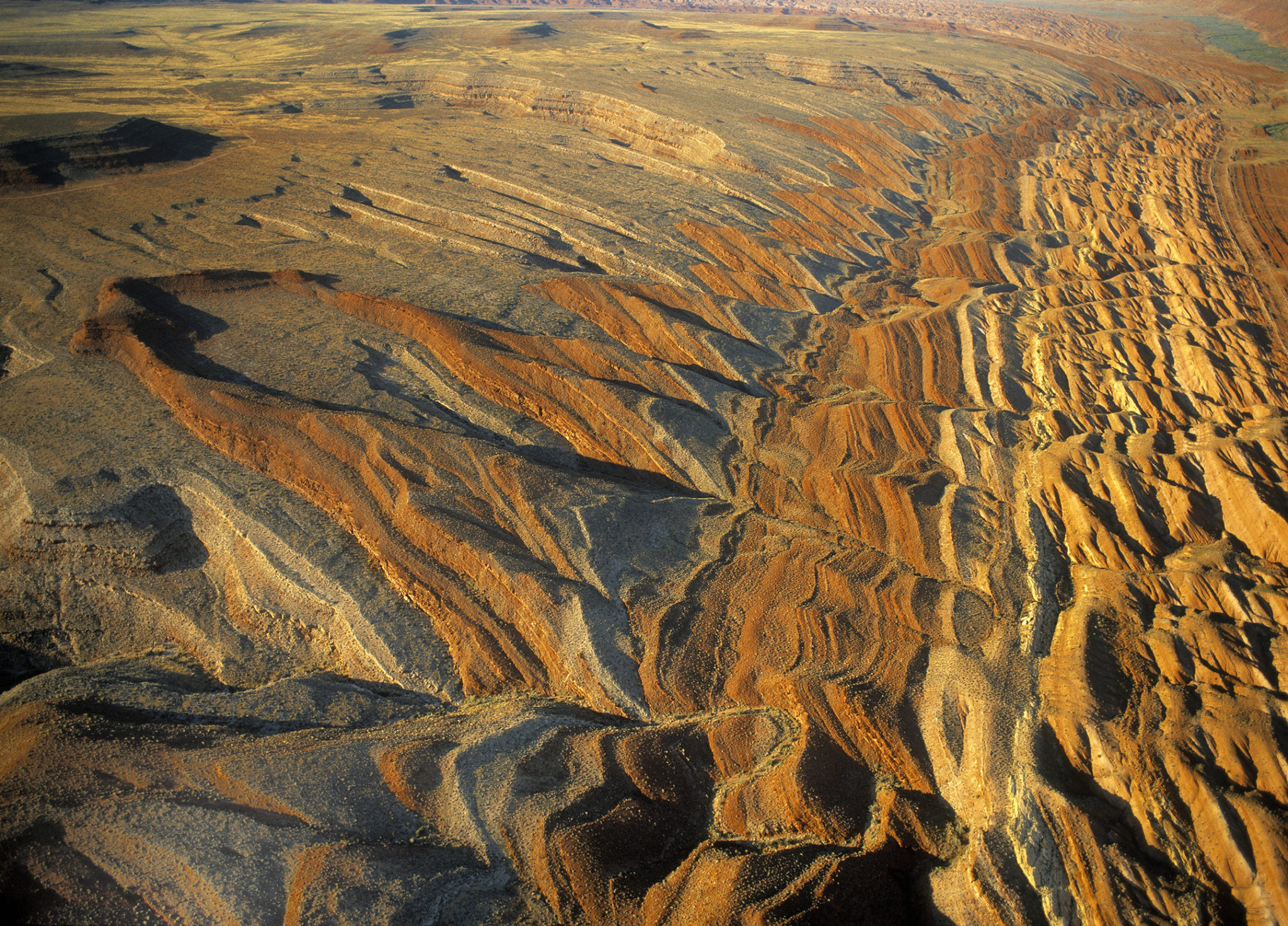
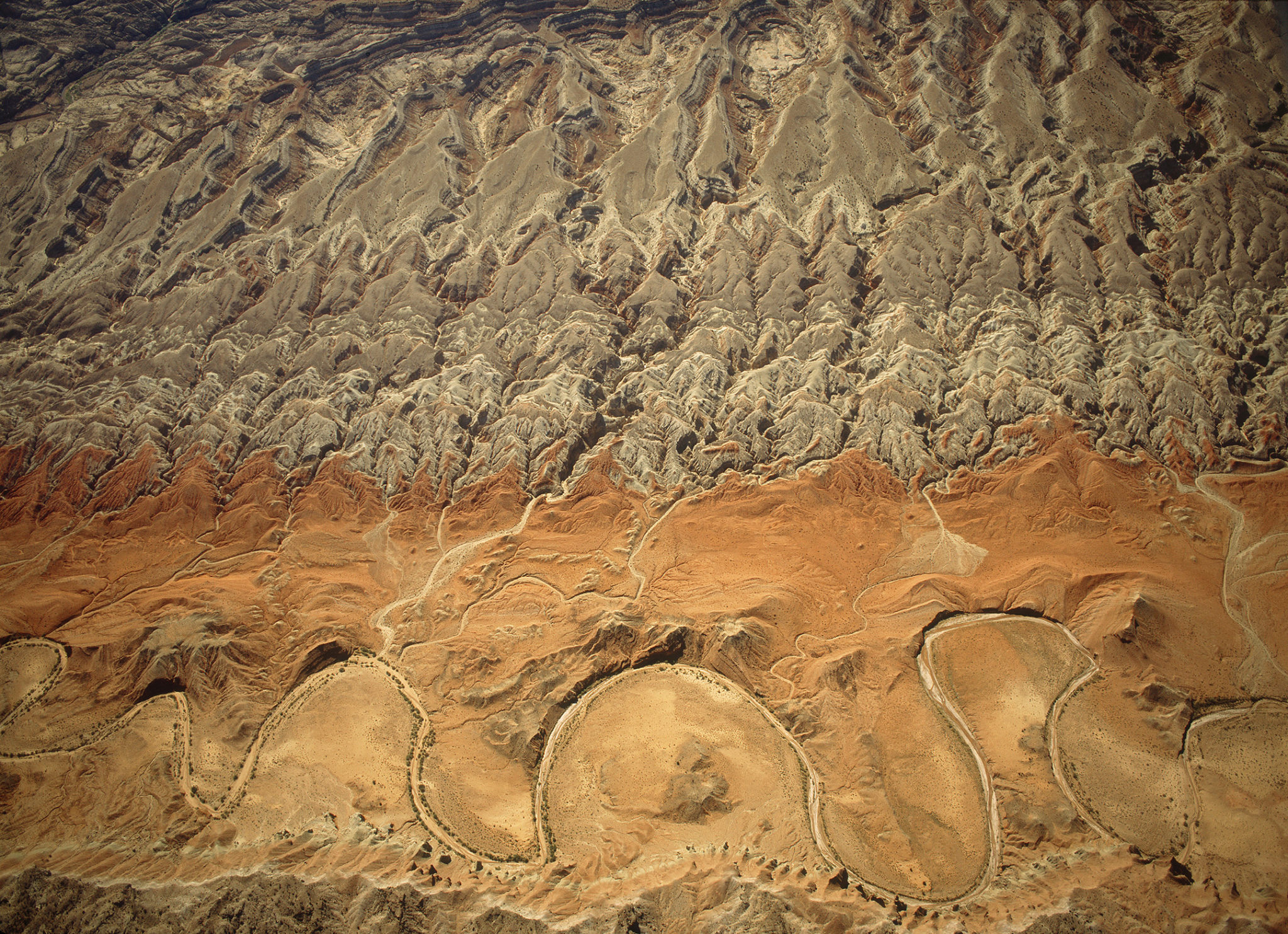
Turning north from the Na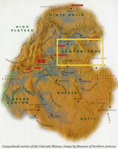 vajo section, we soar high over the colorful heart of the Colorado Plateau: the Canyonlands section. No other name could be so accurate—hundreds of canyons carved by streams both ephemeral and perennial coil through this wrinkled country. From the air we can see them, curling and branching like sinuous tree limbs, intent upon the sea many thousands of feet below. It has been estimated that if one could stretch this landscape to remove all the “wrinkles” on its surface, it would reach two thirds of the way across the United States. In large part because of these canyons, this remained the least known and last explored (by white travelers) portion of the western United States—until the mid-1800’s, the maps showed a huge blank spot here labeled simply as “Terra Incognita.”
The waters of the Green, Colorado, and San Juan Rivers and their tributaries have eroded gorges that rival the Grand Canyon in beauty and extent. They have conspired to create a landscape of leftovers and remnants—of monuments, spires, alcoves, arches, bridges, and buttes. This is a land that challenges the imagination to see what is no longer there.
Mormon pioneers faced challenges of a far different nature in this landscape. Even the smallest of the incised waterways in the Canyonlands section provided obstacles to the wagons, horses, and oxen of the 1879 “Hole in the Rock” party sent east to settle the lands along the San Juan River in the far reaches of the Mormon panorama. A proposed shortcut across the canyon of the Colorado River in Glen Canyon turned into one of the greatest engineering feats in the region’s early history. Roads were literally blasted out of sheer cliffs, log and rock “dugways” patched against the sandstone, and wagons and their teams belayed down more than one of these perilous crossings. A six-week journey lasted six months instead, due largely to this discouraging geography. At the top of their final ascent up Comb Ridge along the San Juan River, one weary traveler stopped to carve into the sandstone cliff the words, “We thank thee oh God.” It takes little effort, when gazing from our aerial perspective over this corrugated land, to imagine the weariness and discouragement felt by pioneers who may have had little appreciation for the beauty surrounding them.
The kaleidoscopic rocks of the Canyonlands section are from the later Paleozoic and Mesozoic Eras, between about 320 and 75 million years old. The red sandstones and shales of Monument Valley and Canyonlands are sediments washed down from the highlands of an ancient mountain range to the east. Here, sail-finned reptiles and lumbering amphibians wandered ancient rivers and deltas during the Permian Period, 280 million years ago. The massive luminous walls of Navajo Sandstone at Capitol Reef National Park and in Glen Canyon preserve dunes across which dinosaurs walked. The austere gray badlands of the Mancos/Tropic Shale near Grand Junction, Colorado, Mesa Verde National Park, and Capitol Reef settled in the waters of the last seaway to cover this land—a Late Cretaceous home to sharks, ammonites, and flippered marine reptiles.
Although it’s hard to tell from the air, the Uinta Basin is structurally the lowest point on the Plateau. Here, the same rock that lies two miles below the surface in the San Juan Basin is as much as four miles below the main street of Vernal, Utah. This is due not only to the general tilt of the Plateau, but also to the downward flexure that created the basin 70 million years ago. Sediments from the Age of Mammals form broad hilly benches that slope to the north; their southern end erodes to form the south-facing Roan and Book Cliffs, marching north to the edge of the Plateau.
The Uinta Basin is strangely lovely—a wil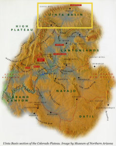 d, open, and often harsh landscape. In the spring, winds blow mercilessly and mosquitoes torment anyone near a water source. In the summer the baking heat sears anything silly enough to be out in the mid-day sun, and in the fall the creeks and rivers are lined with golden cottonwoods, and thousands of Canada geese and sandhill cranes gather at the basin’s waters. Winter temperatures fall sharply and watercourses freeze. Early Mormon explorers to the area were less than impressed with the landscape. They returned a report to Salt Lake City that described the area as, “One vast contiguity of waste and measurably valueless except for nomadic purposes, hunting grounds for Indians, and to hold the world together.” Although Brigham Young convinced the Ute Indians near Salt Lake City to move there because no white settler wanted it, ranchers began to eye the land in the late 1870’s and brought their cattle to graze along the banks of the Green, White, and Uinta Rivers. While this tactic didn’t yield great riches for either Ute or Mormon, their measurably valueless land has since produced substantial quantities of oil and uranium.
At the basin’s northern extreme, the sharply uplifted spine of the Uinta Mountains veers to the sky as the gateway to the Rocky Mountains and Dinosaur National Monument nestles snugly into its southern flank. The Green River exits the mountains and meanders lazily across the pale red and brown badlands. The river here is a calm contrast to the confining walls and rocky falls of the canyons of Lodore and Split Mountain. John Wesley Powell’s 1869 expedition down the Green River had already lost one of four boats by this point in their journey. After the wreck of one boat and the loss of a third of their provisions, Powell became even more dedicated to portaging and lining boats through any rapids they could, a program that didn’t sit well after a time with his men. Despite the distaste for wrecking boats, or carrying gear and lining heavy boats in swift current, however, some of the men preferred swift water to the meandering path of the Green River through the Uinta Basin. George Bradley wrote here in his journal that, “We have had a hard day’s work. Have run 63 miles and as the tide is not rapid we have to row a little which comes harder to us than running rappids (sic).” He also mentions mosquitoes.
We soar down the river as it follows its course southward. The badlands, benches, and cliffs over which we fly are rare (for the Colorado Plateau) remnants from the beginning of the Age of Mammals, rich enough in early mammal remains that entire North American fossil faunas are named for them. These sediments formed in the massive, ancient Green River Lakes and the streams feeding them. They preserve an extraordinary array of fossils, including fish, bird tracks, turtles, early primates, insects, leaves, and feathers.
Paleontological research began here in the latter half of the 19th century, as the astonishing jumble of bones that would be preserved at Dinosaur National Monument came to light. More than a century later, the quarrying at the main site at Dinosaur has been halted in favor of even richer finds elsewhere in the park. Today, pipeline crews crossing the Uinta Basin routinely find fossil sites as they trench. The land holds many undiscovered secrets and treasures.
High Plateau Section
As we make our last great sweep to the west and approach the edge of the Wasatch Plateau in central Utah, the High Plateau section comes into view. This is the highest part of the region, where long forested plateaus are laid out beneath us, parallel splinters of land separated by a series of faults that angle roughly north to south. Stretched beyond its limit tens of millions of years ago, the earth’s crust split and broke into elongate slices that were uplifted and tilted into the High Plateaus of the southwestern Colorado Plateau. Their southern end consists of four escarpments that begin near Kanab, Utah, and climb like steps to the north—the Vermilion, White, Grey, and Pink Cliffs: the Colorado Plateau’s Grand Staircase.
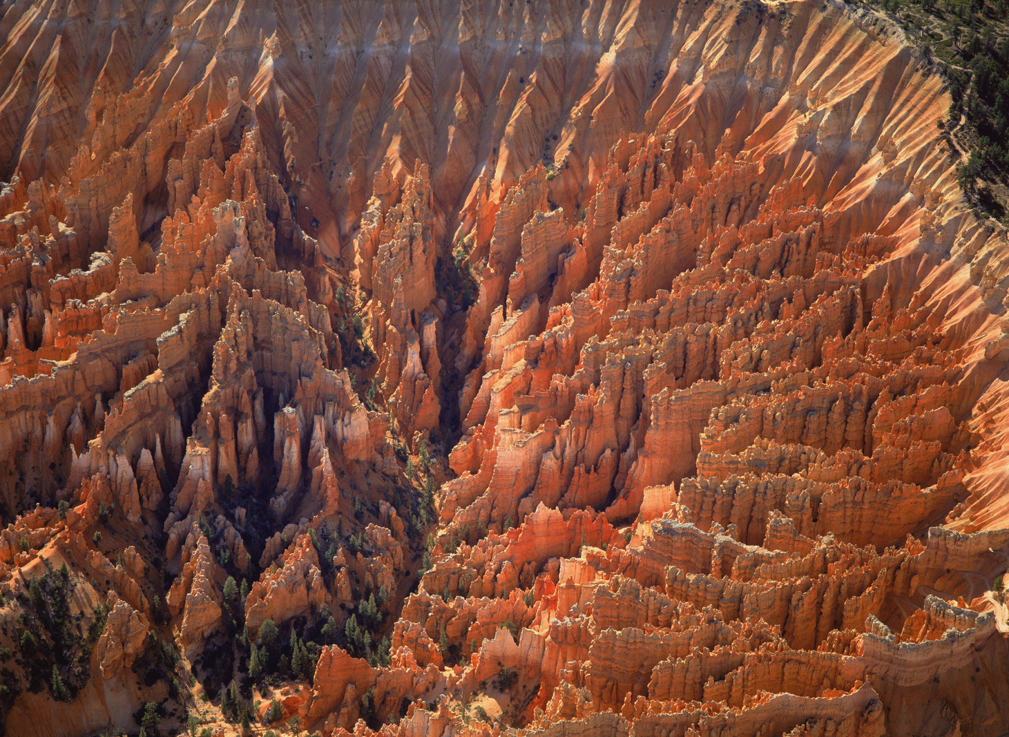
Flying north from the deeply incised cliffs n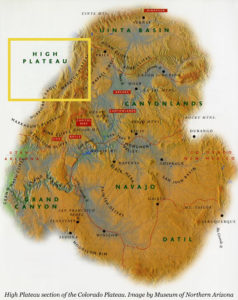 ear Fredonia, we are moving forward in time, covering millions of years in just a few miles. The youngest layers in this cake, the flame-colored lake sediments of Bryce Canyon National Park and Cedar Breaks National Monument, are less than 65 million years old. Imagine each of these grandstand steps extends south to cover even the Grand Canyon, and you can see what erosion has removed in the last few millions of years. The strange hoodoos and goblin shapes of the soft lake sediments of Bryce Canyon and Cedar Breaks are testimony to continuing erosion, the same processes that sculpted the massive domes and kingly thrones of Zion National Park’s gleaming white Navajo Sandstone.
Perhaps more than in any other portion of the Colorado Plateau, this feels like another world. Here there are deep forests and high snows; it feels less like the arid Southwest with its slickrock and painted badlands than like the high mountains of Montana or Colorado. Deep snowfall here in the winter provides water to the streams which eventually join to form the great canyon-cutting rivers. It somehow does not seem surprising that a Columbian mammoth skeleton was discovered on the Wasatch Plateau, at the extreme western edge of the High Plateau section. The old mammoth was out of his range, high up on the plateau’s side, and his old bones still contained preserved collagen, even after 11,000 years. There are places in the High Plateau section where it would hardly be surprising to see an Ice Age dire wolf running in the snowy forests or camels and mammoths grazing on the wide grasslands.
The great faults that separate plateau from plateau have been conduits for many things over the millennia. Millions of years ago, they served as pathways to the surface for molten magma. Brian Head’s volcanic rocks cap the Markagunt Plateau, while farther east lava flowed out over the land less than 2 million years ago. In historic times the tide of Mormon settlement washed south from Salt Lake City, following the valleys eroded along these same faults. Tiny towns sprouted at the bases of the plateaus—watered by mountain streams and rich in fertile bottomlands, they became important agricultural centers until the agricultural depression of the 1920’s and the routing of the main transportation and shipping arteries left them isolated. These faults are also seismically active, and earthquakes regularly rock the torn landscape of the Plateau’s western edge.
This section of the Colorado Plateau is a study in contrasts: red rocks and green pines, snow and sand, high plateau and deep valley. Even the attitudes of the people towards their land illustrate such contrasts. Local Paiute Indians once held that the glorious white-walled canyon of the Virgin River was an evil place because the sun never shone deep in its side canyons. They refused to guide early travelers into it, preferring instead to remain outside the entrance while others explored. Mormon settler Isaac Behunin nonetheless built a cabin there in 1862; to him the canyon was so reminiscent of glory and the spires of Heaven that he named it Zion. Today, the valley called Zion is revered as Utah’s oldest national park.