Photo of the Returning Rapids expedition group at the take-out at Halls Crossing, May 2025. Photo by Mike DeHoff

Essay

River to Reservoir with the Returning Rapids Project

A group poses with a "Dangerous Waterfall Ahead" sign at a boating put in.
The Returning Rapids Project May 2025 expedition poses at their put-in location with the waterfall warning sign at Clay Hills Crossing—the location where boaters typically leave the river. Photo courtesy Beth Henshaw
A woman with pink hair and a pink puffy yales a selfie in front of a washed out waterway with a desert background.

by Beth Henshaw – 10.23.2025 – 15 min. read

On a sunny morning this past May, as a thicket of tamarisk swayed in the wind along the banks of the San Juan River in southeastern Utah, a fleet of metal skiffs, pack-rafts, passengers and guides pushed off downriver from Clay Hills Crossing, the point at which San Juan boaters normally end their trip. The crew posed for a group photo in front of a big sign warning, “DANGEROUS WATERFALL: TAKE OUT ALL WATERCRAFT HERE.” Smiles, high fives and cheers erupted from the group as the boats drifted away from the eerie sign, ready to face whatever perils lay ahead.

The group was headed into what’s known as the Lowest San Juan, a 35-mile stretch that has been under Lake Powell for decades and has re-emerged as lake levels drop due to the Southwest’s prolonged 25-year megadrought. No commercial rafting trips operate this section of river, which has remained largely unexplored due to its inaccessible nature, fluctuating reservoir levels, lack of modern maps, and, perhaps most notably, an 18-foot waterfall.

These boaters weren’t just thrill seekers with a death-by-waterfall wish. They were part of an educational trip organized by the Returning Rapids Project, named for the river features that have re-emerged as Lake Powell has receded. The group, a research branch of the nonprofit Glen Canyon Institute, uses repeat photography and field surveys to document key sections of the Colorado and San Juan Rivers as they are re-exposed by falling reservoir water levels. Each year, they compile their data in annual field binders, with the hope that their findings will be considered to make better decisions on how to manage the Colorado River, perhaps even to decommission Glen Canyon Dam.

Before encountering the dangerous waterfall, the flotilla bobbed over a riffle known as Ledge Drop. A few decades ago this was a sediment-created waterfall known as Piute Falls, named after the nearby Piute Bay and a Navajo Nation-owned marina. Once reservoir levels began dropping in the early 2000s, the falls, the bay, and the marina all dissolved.

Aerial shot of San Juan River
The San Juan River flows through what used to be under Lake Powell. The green plants on the banks show where Lake Powell was at full pool, May 2025. Photo by Beth Henshaw

Without Returning Rapids’ documentation and use of historic photos, a river runner today would not know they were paddling over what used to be a sizable and impassible waterfall. And without memories and photos from the days before Glen Canyon Dam was constructed, they also wouldn’t know how radically the reservoir changed this portion of the river and its canyon.

The San Juan River, according to Returning Rapids’ 2025 field binder, has been pushed out of its historic channel by the reservoir caused sediment deposition. This has resulted in the river falling over cliff bands and these waterfall features acting like secondary dams.

Mike DeHoff and Meg Flynn officially formed Returning Rapids in 2019 and now plan and guide the trips aimed at facilitating access for scientists, sedimentologists, researchers, journalists, government agencies, and conservationists to study and contribute to the story of the river’s reemergence. Their research shows that Glen Canyon Dam not only stores water, it also traps all of the sediment flowing down the Colorado and San Juan rivers. The deposits now are 40-60 miles long, over 120 feet tall, and have “encased the canyon in wall-to-wall mud,” as the organization’s field binder puts it.  “People were talking about the sediment twenty years ago. It has been ignored as part of managing the river. Do we want to keep doing that?” DeHoff said.

As long as Lake Powell’s surface levels continue to fluctuate wildly, the San Juan and Colorado rivers will continue to be pushed out of their historic channels, more waterfalls can be expected, and more massive sediment slumping events will continue, which pose a safety threat for recreationists and can affect water quality.

The May trip was unique, in that rather than collecting data, it was designed to share Returning Rapids’ seven years of research and photography with people who care about the Glen Canyon region. Seven outside participants were chosen from over eighty applicants for a spot on one of the boats. They included scientists, professional rafting guides, outdoor educators, representatives of the Glen Canyon Institute, American Rivers, and The National Audubon Society, and a freelance journalist (that would be me). Participants were selected for the ripple effect they might have of bringing Returning Rapids’ knowledge into their communities, policies, and educational institutions.

Rafters in boats pose for a photo at the bottom of a raging waterfall.
The Returning Rapids Project May 2025 expedition following their hours-long successful portage of Fatt Falls, a waterfall created by sediment loading on the San Juan River, and a major impediment to journeys on this river section. Photo by Beth Henshaw
A boater in front of a waterfall.
Natalie Tanski paddling below Fatt Falls, May 2025. Photo by Beth Henshaw

“What makes Returning Rapids especially unique is how far their communication reaches: professional researchers, park managers, conservation groups, local communities, students…the list just keeps going,” said Natalie Tanski, a postdoctoral researcher of geoscience and trip participant. “This got me thinking about how we communicate science within academic institutions. One way forward might be to widen the circle, not only in terms of who our science serves, but also in how we share it.”

After two hours of floating downriver, a rumbling in the distance permeated the quiet, still water, warning boaters of the approaching Fatt Falls. Glassy water slid over the edge and crashed back into the sky as the skiffs and packrafts were beached before the 18-foot waterfall, formed by impounded sediment and shifting reservoir levels. Fatt Falls is not runnable, meaning boaters have to portage the boats and all of their weighty gear must somehow be moved from the top of the falls to the other side.

Flynn and DeHoff have experimented with various methods since first running this section in 2022, including carrying the heavy, cumbersome boats down a talus slope. This time they kept the boats in the water, tied them on belay and used inflatable roller tubes to ease the empty metal skiffs down the falls. Meanwhile, participants passed their gear down the falls in a fire-line, a process that took several hours.

“Who could have known that putting in a dam would make mud riffles, cause the San Juan to change channels, and make waterfalls? There’s a lot more unknowns to discover,” said Anna Penner, a participant on the trip and the Development Coordinator at Glen Canyon Institute.

When Lake Powell was at full pool, from 1980 to 1983, the reservoir inundated 60 miles of the San Juan River and extended all the way to Clay Hills, drowning native plant life, displacing animals, and piling up sediment along the river corridor. When the reservoir receded, the resulting mudflats were colonized by non-native plants.

Boaters in boats on choppy water.
Returning Rapids May 2025 expedition crew members paddling next to a wall of built up sediment, and, in the background, boats lodged in the shallow, sandy water. Photo by Mike DeHoff

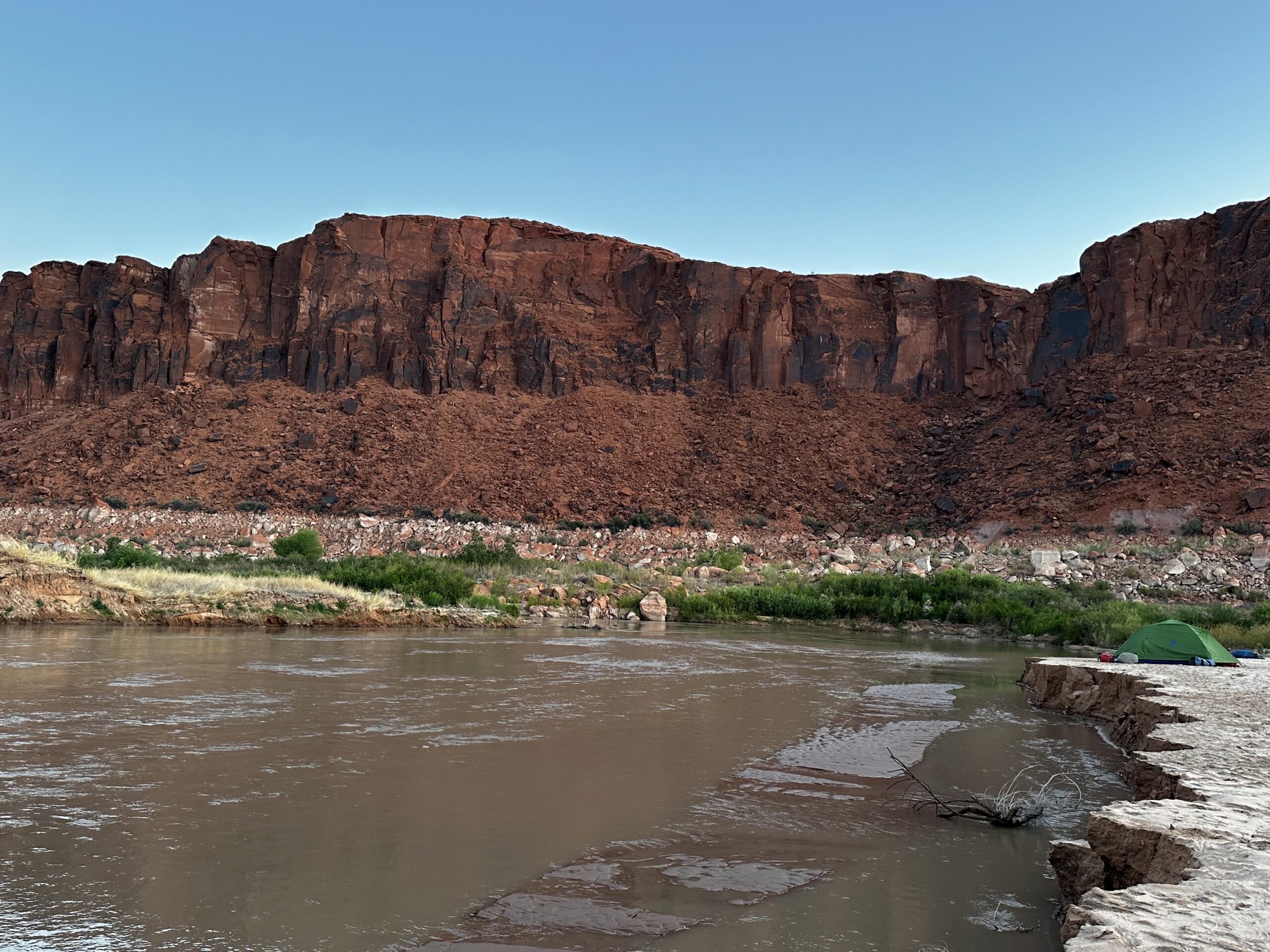
While traveling downstream from Fatt Falls, DeHoff and Flynn pointed out the abundant invasive species along the banks of the San Juan, including tamarisk, Russian olive, and Russian thistle, which rooted in the disturbed ecosystem in Lake Powell’s absence. In areas where the San Juan River has continued to flow for several years without being re-inundated by the reservoir, native species like coyote willow and cottonwood returned without any human intervention and are starting to out-compete invasive species. Coyote willow’s roots are better adjusted to a fluctuating river, periodic flooding, and an unstable streambank compared to tamarisk, which tend to die off when their root systems are disturbed.

“Traveling through a reborn river corridor—transformed from reservoir back to a thriving riparian ecosystem, was nothing short of profound,” said Abby Burk, Senior Manager of Audubon Rockies’ Western Rivers Program and a trip participant. “To see native willow, cottonwood and to encounter beaver activity, all signaling ecological renewal, was a humbling reminder of the resilience of riverscapes when given the chance to heal.” During the trip, Burk identified 39 bird species along the San Juan arm and on Lake Powell.

 “I felt so much hope seeing the river returning and getting to float those river miles. When I’m writing grants and talking about the future of Glen Canyon, this trip is the foundation of my knowledge,” Penner said.

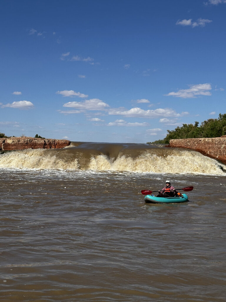
After 30 river miles, paddlers encountered Stick Riffle, named by the Returning Rapids crew members after a stand of coyote willow that re-established itself during the historically low water year of 2023, when Lake Powell was 23% of full pool. DeHoff shared stories of seeing a huge grove of standing coyote willows, two miles long and ten feet tall. When the snow melted in summer 2023 and the lake rose back to 37% of full pool, the rising water killed the coyote willow. This May, the tops of the submerged willows poked out of the water, creating a wave and obstacle for paddlers to traverse.

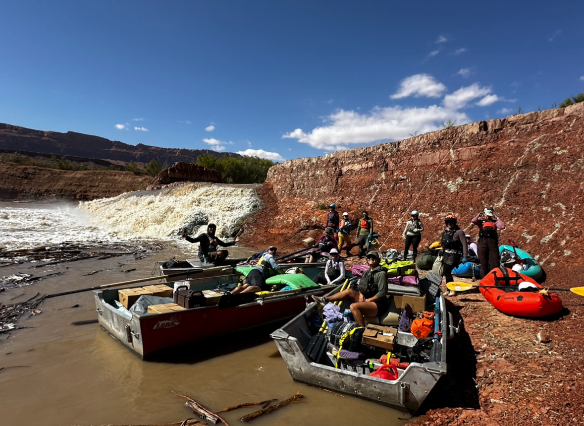
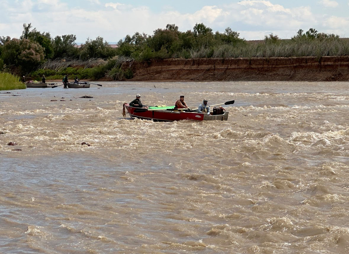
“If you’ve never seen a river die into a reservoir, get ready. It can be emotional,” DeHoff warned participants. Forward progress slowed as the boats frequently became impounded on shallow sand. The river’s flowing current became harder to decipher as it gradually disappeared into Lake Powell, once advertised as the “Jewel of the Colorado.”

Instead of a shimmering emerald lake, however, soupy, shallow water, filled with silt and debris, stretched from sandstone wall to sandstone wall. The metal skiffs scraped bottom and became hopelessly stuck, but the crew warned that there was a “no getting out of boats” rule on this section of the trip. “We’ve seen people sink into quicksand up to their chests here,” DeHoff said, much to the frustration of the skiff boaters, who were rocking side to side in an attempt to be free from the sludge. In the shallow river corridor, passengers were able to safely step out and push the boats back into the current. Without a current or stable floor, the boats were entrenched in the mud for half an hour before it was deep enough to turn motors on.

A desert waterway with red rock in the background.
High water mark (white line) on the San Juan River with eroding sediment, May 2025. Photo by Beth Henshaw

Mixed feelings abound when a river turns into a reservoir. On one hand, it marks the line where a free-flowing river is confined, on the other there is also beauty—and life—in the way the reservoir’s blue water reflects the stone walls and cloud-dappled sky. Plus, it makes for a good aquatic playground, for motorized and non-motorized recreationists alike.

“From my observations, stagnant, reservoir water equals death,” Flynn said, clearly sad to leave the river behind. “Flowing water equals more life. I want to see the San Juan and Colorado River flow freely again.”

For river runners, this transition zone was also frustrating, because they no longer got to row in a quiet, trancelike flow-state, but would now be forced to crank up the growling diesel motors to get the group to Halls Crossing, 70 miles away. Packrafts were rolled up and paddlers became mere passengers.  

The exposed river miles with revitalized habitat and renewed animal presence revealed what might happen to the San Juan River if Lake Powell was drained to “Fill Mead First,” the Glen Canyon Institute’s proposal to address critically low water in both Lake Powell and Lake Mead. That would entail either decommissioning Glen Canyon Dam or leaving it intact but turning it into a “run-of-the-river” facility that releases the same amount of water that flows into the reservoir and slowly drawing down the lake. The idea is growing in popularity among conservationists, but remains unpopular among the millions of Lake Powell recreation users.

In the end, nature and a drying climate may make the question moot, said Nicole Milavetz, a participant and Southern Utah Wilderness Alliance organizer. “Recreation on Lake Powell has already peaked,” she said. “Most boat ramps don’t exist anymore. Hite, Piute Farms, and North Wash are all unusable. I don’t see a future for recreation with a low lake.”

The seven Colorado River Basin states have until mid-November to come up with a plan for managing the river and its dams and sharing the diminishing amount of water it delivers to some 40 million users.  The 2025 water year, which ended on Sept. 30, was the 6th driest on record since 1964 for the Colorado River Basin, according to the U.S. Bureau of Reclamation, and the lowest storage value observed on July 15 in the last 30 years. 

Boaters camping at the banks of a waterway with a bathtub ring on the sandstone in the background.
Returning Rapids expedition group camps at Lake Powell, May 2025. Photo by Beth Henshaw

The USBR’s August “probable minimum” forecast indicated that the reservoir could drop below the minimum power pool by the end of 2026. That would force dam managers to either dramatically curtail downstream releases to keep the water level stable, or use the river outlets at the bottom of the dam, which were not designed for long-term use and which could fail.

“We are in a defining moment for the Colorado River. With chronically low Lake Powell levels, rising sediment, and growing pressure from climate-driven water stress, the need to act has never been clearer,” Burk said.

Participants are carrying their experience, observations, and newfound knowledge from this river to reservoir trip back to their careers and communities. On Nov. 13, Burk, Tanski, and I, along with members of Returning Rapids, will present as keynote speakers at the Rivers of Change Symposium in Moab, Utah. This conference is open to the public and will be the first of its kind, reckoning with the impacts of the Glen Canyon Dam, co-hosted by Returning Rapids, Glen Canyon Institute, and the University of Utah.

“Our generation is not preventing the dam. Our work is to speak out about the changes happening and show the story of recovery,” Penner said. “The magic and spirit of Glen Canyon is still alive. That’s worth fighting for.”

A woman with pink hair and a pink puffy yales a selfie in front of a washed out waterway with a desert background.
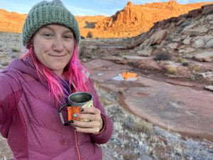
Beth Henshaw is a writer and outdoor educator based in Page, Arizona. She is pursuing her M.F.A. in creative nature writing at Western Colorado University and publishes regularly on her blog www.empathicadventurers.com. Her videos and repeat photography of Lake Powell’s fluctuating lake levels have reached over 30 million views on her Instagram (@blog_by_Beth).


Leave a Comment

Your email address will not be published. Required fields are marked *

Scroll to Top

Subscribe Now

Become a subscriber and be the first to know when new articles are released and to hear the latest Corner Post news!